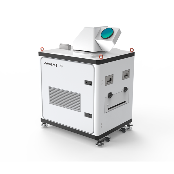
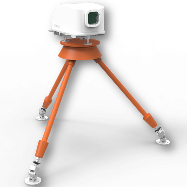
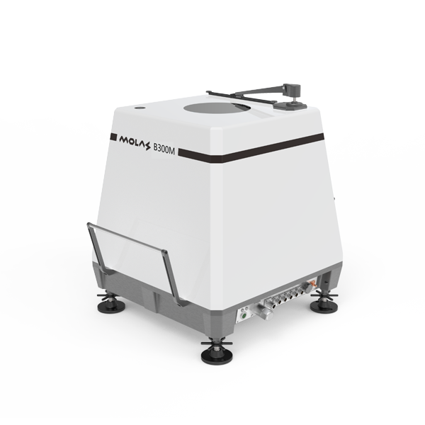
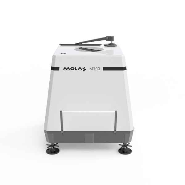
Small volume and weight, convenient for installation and transport
Can be easily configured with wireless and easy data download
Wireless access
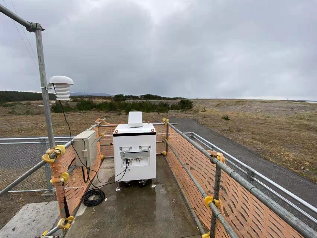
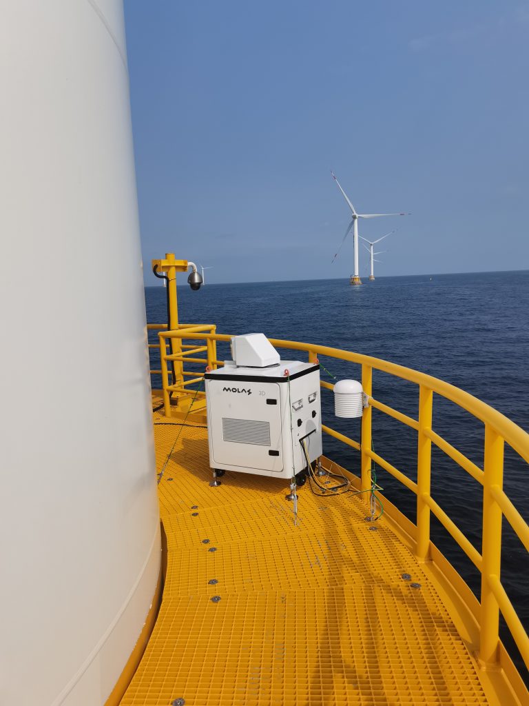
Can be deployed quickly under harsh onshore & offshore sites
The scanning system of Molas 3D scanning wind LiDAR has strong programmability and high wind measurement accuracy, and it can be applied for wind measurements for wind projects, aircraft wake vortex and dangerous meteorological detection for civil aviation industry, high precision wind profile measurement, and emission source tracking for air quality application field.
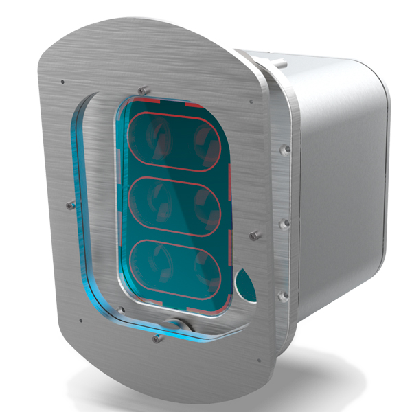
Molas 3D Scanning Wind LiDAR System
Specifications
Distance Measurement Parameters
Measurement Distance: 8km (Corresponding to 75m distance resolution)
4km (Corresponding to 30m distance resolution)
Distance Resolution:30m/75m
Accumulation Time:0.5s/1s/2s/4s/8s Optional
Wind Speed Measurement Accuary: 0.1m/s
Pointing Accuracy:0.1°
Wind speed measurement range:-75m/s to 75m
Vertical Scan Range:-10°~190°
Compliance
Eye safety: IEC / EN 60825-1 ANIS Z136-1
Anti-corrosion level: C4
Anti-corrosion grade: ISO C5
Data Output
Communication method:
customizable
Others
Power Supply: 110VAC ± 20%
or 220VAC ±20%
Dimensions: 800X650X1130mm
Weight:<150kg
Working Environment
Working Temperature Range:-20℃ ~ 50℃
Survive Temperature Range:
-40℃ ~ 65℃(Power off)
-45℃ ~ 65℃(Power on)
Working Humidity Range: 0~100%RH
Protection Level: Housing IP54 Inner Module IP66
Molas 3D Scanning Wind Lidar Applications
Wind Resource Area
Wind resource assessment: Molas 3D can measure a wide range of regional wind farm information and optimize wind farm site selection;
Power curve test, wake eddy current measurement, optimize wind energy utilization and enhance the performance of WTGs
Civil Aviation Industry
Detect and early alert dangerous metorological phenomena, such as wind shear, micro downburst etc.
Measure wake vortex to optimize Flight Separation of airport traffic control.
Meteorological Measurement
The information of wind field is provided to understand the state of wind in boundary layer
It can provide accuracy and high precision wind profile information within a few kilometers near the surface to fill the gap of low altitude monitoring.
Air Quaility Testing Field
Real-time 3D information of smoke and rain diffusion to track the emission sources
Optimization of dust emission control in mining industry
The scanning system of Molas 3D scanning coherent Doppler lidar has strong programmability. The measurement plan and Lidar scanning mode configuration can be developed as per scope of the measurement and site conditions.
Molas 3D Wind Lidar Scanning Modes
The scanning system of Molas 3D scanning coherent Doppler lidar has strong programmability. The measurement plan and Lidar scanning mode configuration can be developed as per scope of the measurement and site conditions.
Wind profile is the change curve of horizontal wind speed in the atmosphere with altitude. Molas 3D can continuously collect the Wind profile information directly above equipment, by measuring Radial wind speed of the five directions of east, south, west, north and vertical in turn, to calculate wind speed and wind direction profile data.
2. PPI (Plan Position Indicator) scanning - Molas 3D scanning wind lidar
Molas 3D scans the radial wind speed over a large area with a fixed pitch angle and varying azimuth angle. This scanning method can clearly see the change of radial velocity information on the scanning surface, which is suitable for retrieving horizontal wind field at relatively flat terrain, or fine measurement the amount of wake, wind shear, etc.
Molas 3D scans at a fixed azimuth and changes the pitch angle, scanning one or more vertical plane slices from top to bottom or bottom to top. This scanning method is suitable for observing changes in wind speed on the vertical plane.
4. VAD (Velocity Azimuth Display)
This scanning method can measure the wind speed information at any point within the detection space of the equipment. Based on the assumptions of a uniform horizontal wind field at the same height and an unchanged wind field within the measurement time, synchronized control of multiple 3D scanning lidar enables efficient and accurate measurement of wind resource information at various points.
5. Dual lidar virtual wind measurement tower
This method can measure blade loads and scan the wind field at a distance of nD in front of the wind turbine, replacing wind measurement towers with dual lidars. It effectively addresses the high cost and strict terrain requirements of wind measurement towers. This method is usually combined with some customized inversion algorithms or aims to improve the time resolution of PPI/RHI and speed up the acquisition of individual PPI/RHI scans.
Project examples of MOLAS 3D Scanning wind Lidar
Civil Aviation Projects
Product: Molas 3D scanning Lidar;
Customer: Air traffic control department ;
Project Scope: Aircraft tail vortex and wind shear detection